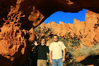
There is a never ending supply of places to explore and new things to see. Every time I come here I find new formations, ravines and arches.


 Disclaimer: Sorry about the photo quality, I was messing with my settings on my camera a couple weeks ago and never reset them!


 Marie holding Emma (above)
Cory taking a typical Cory shot! At least this time he wasnt lying down in the middle of the road. Fortunetely he has not yet been struck by a speeding car.
 One of the most impressive vistas was the Fire Canyon Overlook. It was amazing how the red and white color change was so abrupt.

Marjory Kay really wanted to go on a hike so we hike the White Dome loop. This was a fun/easy trail that had a little bit of fun for everyone. There was scrambling, slot canyons and arches to explore and photograph all in a 1 1/2 mile hike.


 One of my favorite parts of VOFSP is rock art record left by ancient inhabitants. Even in such a desolate, out of the way place, ancient civilizations found the place to be sacred as proven by the record of petroglyphs. The first picture is of the famous atlatl rock. I have a better pic of the atlatl that I will find later, but if you look at the very top you can barely see the atlatl.
Perhaps the most fun hike that the Reese children did was the hike to Mouses Tank. Mouse was a renegade Paiute who plagued the early settlers. He would hide in this canyon when the early white settlers searched for him. The reason the kids liked the canyon so much was the amount of lizards they found and unsuccessfully attempted to catch. I think Jackson counted over 20. I enjoyed the hike because in half a mile hundreds of rock art was easily found. My favorite one was a panel that included a desert tortoise.

Even pregnant, Renee is still HOT!!


A petroglyph of a desert tortoise (below, middle of picture)


Overlooking LaVerkin and West Temple (ZNP)


We saw some CRAZY weathering of rocks!

Even the moss was more artistic in the RCDR

Some of the differences in color of the sandstone was similar to the Wave.


Just the icing on the cake of a perfect day